Making Data-Driven Decisions Using GIS and 3D Groundwater Modeling
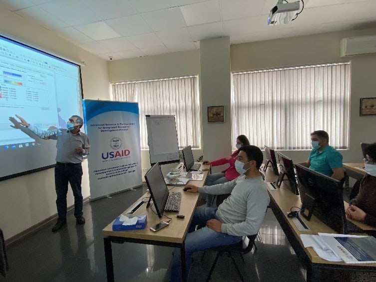
Making better decisions using geographic information systems (GIS) and three-dimensional groundwater modeling was the topic of a recent two-week training under the USAID-funded Advanced Science and Partnerships for Integrated Resource Development (ASPIRED) project.
The training — designed for officials from the Ministry of Environment as well as academic institutions — included hands-on learning and practice with sophisticated software tools for groundwater modeling: ArcHydrgoGroundwater (AHGW), GMS, and Modflow tools. Like with the broader ASPIRED project, the training’s ultimate goal was reducing the rate of groundwater extraction in Armenia’s Ararat Valley to sustainable levels.
“During the training we designed a 3D model of three water-bearing layers of the Ararat Valley artesian basin based on the inventory data of 2016….In my opinion, the training was highly relevant and effective for the specialists of water sector agencies interested in the creation of similar models,” said participant Harutyun Yeremyan from the Hydrometeorology and Monitoring Center of Armenia’s Ministry of Environment. “By working with the models, inputting new data, and considering different scenarios, the specialists will be able to make projections on the impact of the groundwater abstraction increase or reduction and the possible positive or negative dynamics of the groundwater resources. I am sure the application of these models will contribute to a more sustainable management of groundwater resources.”
To understand the state of the Ararat Valley’s groundwater resources and resilience to changing conditions and external pressures, the ASPIRED Project designed the three-dimensional model and the groundwater flow model of the artesian basin aimed at supporting data-driven decision making on groundwater resources. The 3D model of the Ararat Artesian Basin presents the hydrogeologic structure and the water bearing potential of the basin, while the groundwater flow model provides data on the water pressure, water availability and balance, and water movement directions in the water-bearing layers of the artesian basin. The model can help decision-makers to predict improvement in the pressure or level increases/drops in water bearing layers of the Artesian basin.
At the end of the training, participants received a full package of information including the User Manual, the 3D model and groundwater flow model of the Ararat Valley’s artesian basin as well as support data templates and data for simulation of the models. The ASPIRED team will further assist participants to activate the modeling software and provide necessary guidance.
USAID/Armenia awarded ASPIRED to ME&A as a task order under the Water and Development Indefinite Delivery Indefinite Quantity Contract (WADI) providing the USAID Bureau for Economic Growth, Education, and Environment with services and technical support to assist USAID’s Missions, Bureaus, and Offices worldwide in the implementation of the Agency’s Water and Development Strategy.
Under ASPIRED, ME&A collaborates with the USAID/U.S. Global Development Lab/Center for Data, Analysis, and Research (DAR), the U.S. Geological Survey, and other relevant institutions to pilot innovative technologies for water conservation and fish farms; establish transformational partnerships; and promote evidence- and science-based water resource monitoring, planning and management. In addition, ME&A also works with the private sector, academia, and other donors to leverage their resources and expertise in the Armenian water and energy sector.


